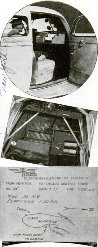
Facsimile Unit in Airplane Sends Map by Radio

Item

Flying down the eastern shore of Lake Michigan an aviator notices a U. S. army plane grounded and signaling for aid. Continuing on his course, the pilot sketches a map of the lake, marks with an “X” the approximate location of the disabled plane, inserts the sketch in the two-way facsimile unit at the right of the cockpit and transmits message and map by radio to the Chicago airport. This is an example of the peacetime usefulness of the Finch facsimile device now being installed in airplanes as well as in police squad cars, where they “stand by” to receive or transmit pictures and reports. In military planes the units can radio to headquarters the location of troop concentrations, artillery emplacements and similar information, in complete secrecy, transmitter and receiver being coordinated to “scramble” the message into a hodgepodge which only the receiver can decode.

Title (Dublin Core)

Facsimile Unit in Airplane Sends Map by Radio

Subject (Dublin Core)

Article Title and/or Image Caption (Dublin Core)

Facsimile Unit in Airplane Sends Map by Radio

Language (Dublin Core)

eng

Temporal Coverage (Dublin Core)

Date Issued (Dublin Core)

1940-06

Is Part Of (Dublin Core)

pages (Bibliographic Ontology)

806

Rights (Dublin Core)

Public Domain (Google digitized)

Source (Dublin Core)

References (Dublin Core)

Archived by (Dublin Core)

Enrico Saonara
Alberto Bordignon (Supervisor)

Spatial Coverage (Dublin Core)

Item sets