Shelters used on the front line to protect maps
Item
-
Title (Dublin Core)
-
Shelters used on the front line to protect maps
-
Article Title and/or Image Caption (Dublin Core)
-
"Here's Where We Licked Them"
-
extracted text (Extract Text)
-
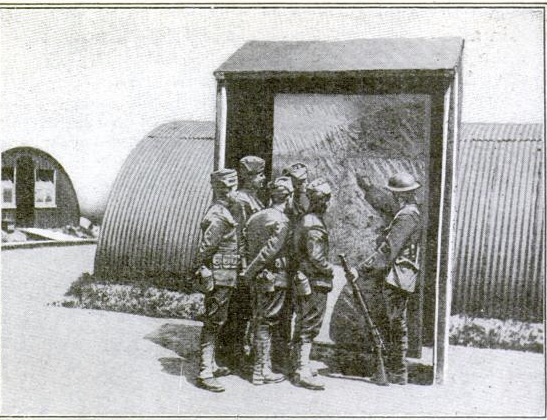
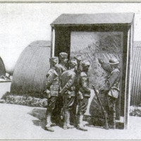
MAPS, are even more important to an army than to a stranger
in New York's subway maze. Big war maps were in evi-
dence everywhere om the western front.
They were housed in shelters like the one
shown above, where a British Tommy seems
to be telling a squad of our boys just how
and where it all happened. The map they
are looking at shows the western front as a
whole, but maps similarly sheltered show
in great detail portions of the front, usually
those directly opposite the trenches.
The quickest way to get maps is to send
a photographer out with an aviator to fly
over the country to be photographed.
-
Contributor (Dublin Core)
-
International Film Service (Image copyright)
-
Language (Dublin Core)
-
eng
-
Date Issued (Dublin Core)
-
1919-01
-
pages (Bibliographic Ontology)
-
34
-
Rights (Dublin Core)
-
Public domain (Google digitized)
-
Archived by (Dublin Core)
-
Davide Donà
-
Marco Bortolami (editor)

 Popular Science Monthly, v. 94, n. 1, 1919
 Screenshot (388).png