Markers set at intervals of 10 nautical miles to simplify navigation for planes
Item
-
Title (Dublin Core)
-
Markers set at intervals of 10 nautical miles to simplify navigation for planes
-
Article Title and/or Image Caption (Dublin Core)
-
Flyers' signposts
-
extracted text (Extract Text)
-
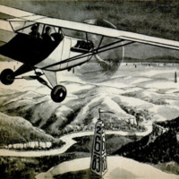
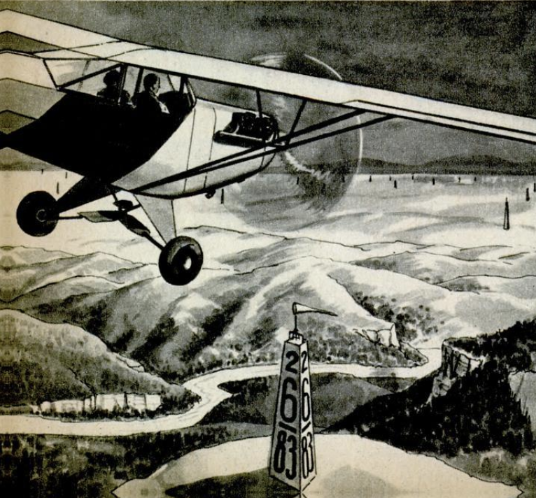
FLYERS’ SIGNPOSTS. To sim-
plify navigation for the thousands
who are expected to fly their own
planes after the war, Prentiss
Cleaves, experimental test pilot
for the Cessna Aircraft Co. of
Wichita, Kans., suggests dot-
ting the United States with
markers set at intervals of 10
nautical miles to indicate the
latitude and longitude of a plane's
position. These markers would
be 100-foot pylons painted orange
so as to be plainly visible, and
‘would carry huge numbers show-
ing latitude and longitude in min-
utes. By noting the numbers on
the nearest pylon, and then re-
ferring to an aeronautical map
showing the locations of these
markers, a pilot could quickly
determine his position.
-
Language (Dublin Core)
-
eng
-
Date Issued (Dublin Core)
-
1944-02
-
pages (Bibliographic Ontology)
-
102
-
Rights (Dublin Core)
-
Public Domain (Google digitized)
-
References (Dublin Core)
-
Cessna
-
Archived by (Dublin Core)
-
Lorenzo Chinellato
-
Marco Bortolami (editor)

 Popular Science Monthly, v. 144, n. 2, 1944