Topographical engineers create maps assembling air photos in less than 20 hours after order
Contenuto
-
Titolo
-
Topographical engineers create maps assembling air photos in less than 20 hours after order
-
Article Title and/or Image Caption
-
Title: The general gets his map
-
Subtitle: Topographical engineers perform a 20-hour miracle to chart the path to victory in fast-moving attack
-
extracted text
-
RECONNAISSANCE radio flashes the
news. Retreating enemy forces, hard-
pressed on the flanks and pounded in the
middle, have blown up the great bridge,
cutting off pursuit by our armored division.
It could be a serious setback. But let's
see how an American general will handle it.
Minutes after receiving the news, the
general dictates an order. It's a curious
order. He doesn't want assault boats, bridge
repairmen, or amphibious jeeps. He wants
a map—a particular kind of map—at once.
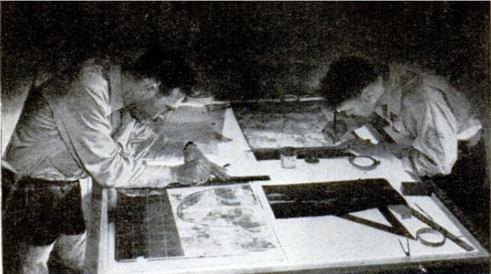
To the rear, in carefully camouflaged
operational position, topographical engineers
await just such an order. The boss of the
outfit is an alert young lieutenant. His
company functions like a miniature bat-
talion. It has three platoons—one for field
survey, another for camera-reproduction
work, and the third comprising computers,
draftsmen, and photographers. They are all
alert for the call that comes clicking into
the command-post tent.
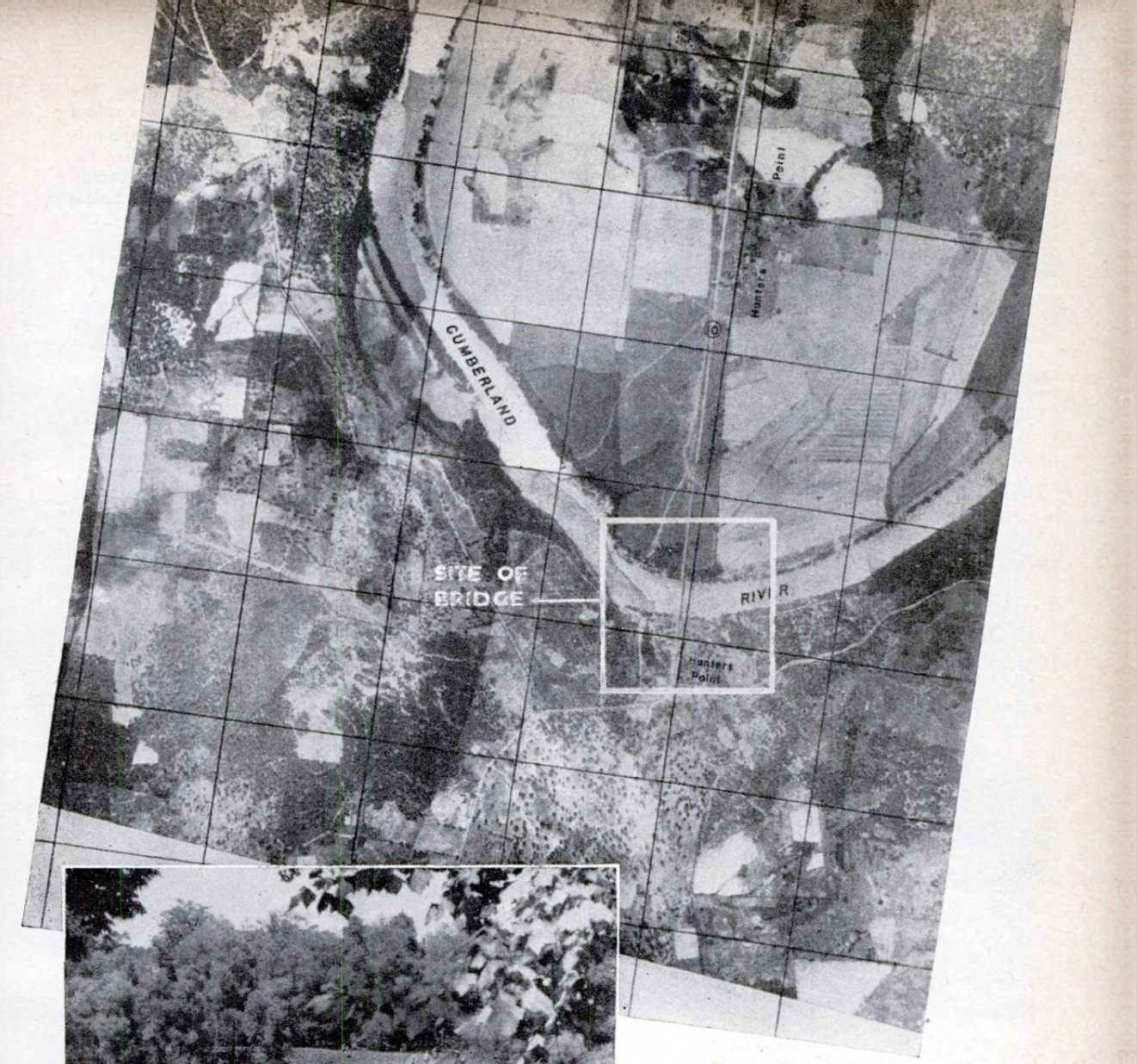
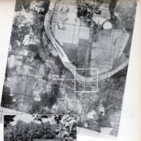
It reads: “Rush photo map HP-C area
showing bridge site and vicinity both sides
river. Prepare 5,000 copies immediate de-
livery our units here.”
The lieutenant immediately puts through
a request to air-support command for aerial
photographs of the area.
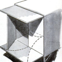
At air-support headquarters, a young re-
connaissance pilot is assigned to the mis-
sion. He's off in a cloud of dust, and soon
his automatic, oblique-set camera is clicking
sequence shots of the bridge area below. He
lays his course carefully, shooting the area.
in strips as he flies back and forth. A 60-
percent overlap is allowed on each strip
to give the map makers plenty of prints to
work with. “Shooting” completed, the pilot
stuffs the film into a tube and lets it para-
chute down over “Topo” headquarters,
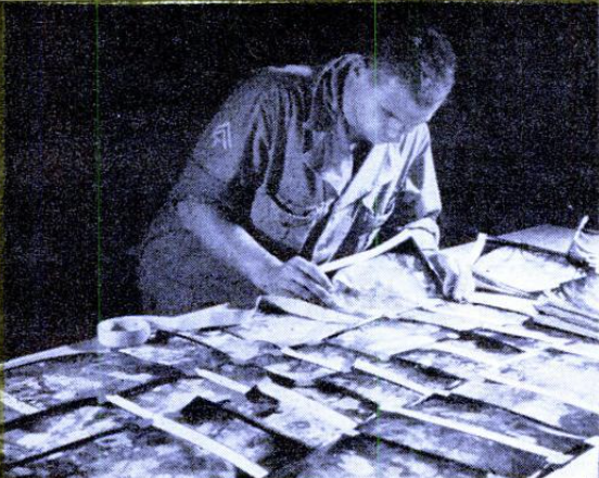
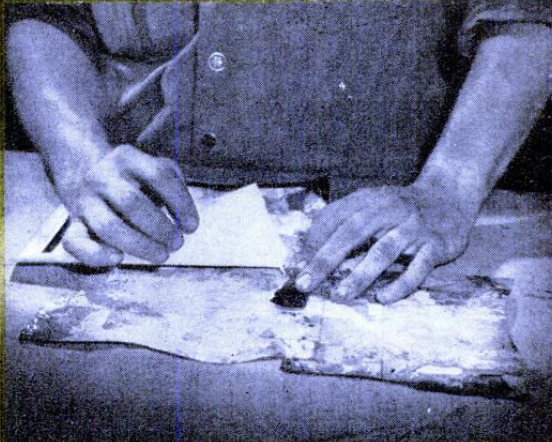
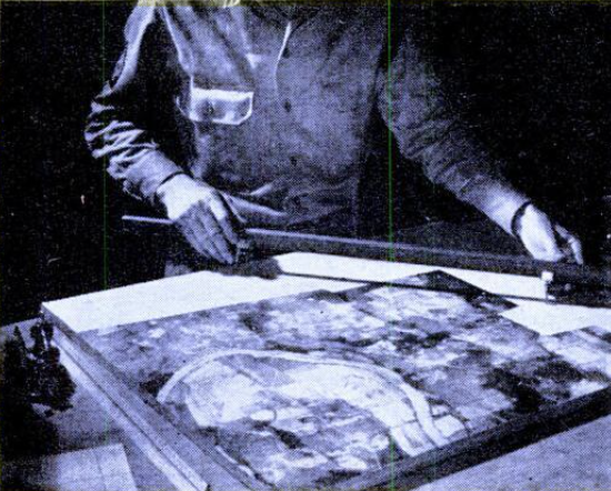
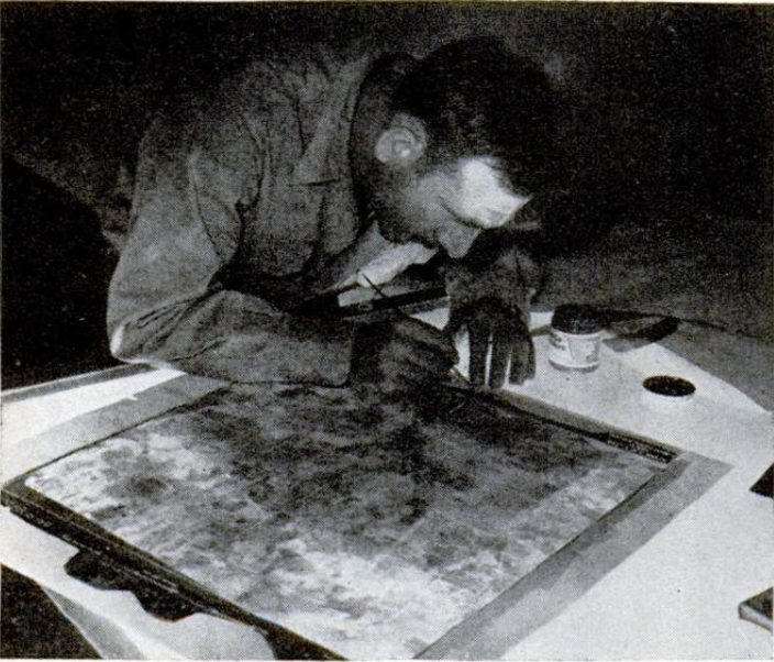
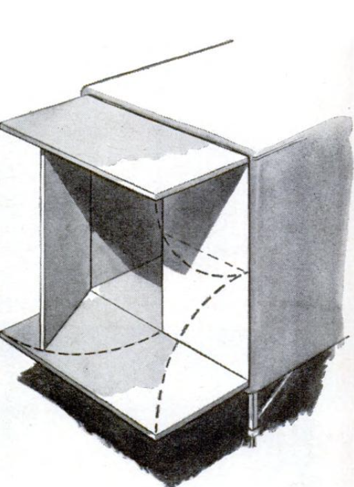
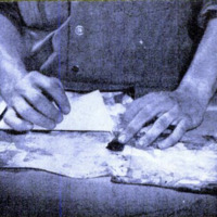
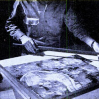
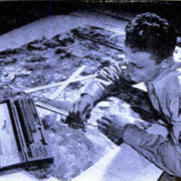
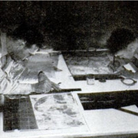
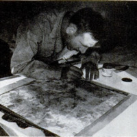
Map makers are waiting. This is where
they go to work. Their step-by-step pro-
gress is shown on these pages in pictures
and drawings. The miracle: Less than 20
hours after the general's order arrives, 1e
topographical engineers have placed in their
commander's hands a slick, 20 by 2214-inch
mosaic of the bridge area, and 5,000 copies
have reached the units concerned. Should
more be required, they can be run off at the
rate of 5,000 an hour.
But why the map? It's the general's key
to future operations. It tells him at a glance
the safest, most practical point at which to
fling a ponton bridge across the stream. It
shows him the exact width of the river at
that point. Revealing the position of the
enemy with relation to this operation, the
map indicates how much armed protection
will be necessary. It shows the situation of
roads on the opposite river bank
and, equally important, what to
expect in the way of natw al con-
cealment for assault troops estah-
lishing the bridgehead. With the
map before him, the general
knows just what to do to over-
come the temporary advantage
achieved by the enemy in blow-
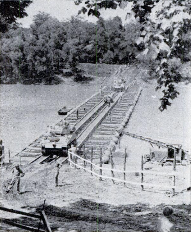
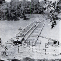
ing up the big bridge. His orders
rattle off—and, only three hours
from the time he received the
photo map, our armor goes pound-
ing across a new bridge to take
up the pursuit of the enemy. Con-
structed of pontons and steel, the
bridge can be built to span as
much as 330 feet of water.
-
Autore secondario
-
Jack O'Brine (article writer)
-
William W. Morris (photographer)
-
Lingua
-
eng
-
Data di rilascio
-
1944-03
-
pagine
-
111-113
-
Diritti
-
Public Domain (Google digitized)
-
Archived by
-
Lorenzo Chinellato
-
Marco Bortolami (editor)