-
Title (Dublin Core)
-
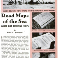
Road Maps of the Sea Guide our Fighting Ships
-
Article Title and/or Image Caption (Dublin Core)
-
Road Maps of the Sea Guide our Fighting Ships
-
extracted text (Extract Text)
-
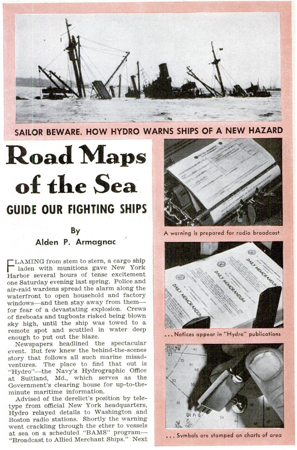
FLAMING from stem to stern, a cargo ship |
laden with munitions gave New York |
Harbor several hours of tense excitement
one Saturday evening last spring. Police and
air-raid wardens spread the alarm along the |
waterfront to open household and factory
windows—and then stay away from them—
for fear of a devastating explosion. Crews
of fireboats and tugboats risked being blown
sky high, until the ship was towed to a
remote spot and scuttled in water deep
enough to put out the blaze.
Newspapers headlined the spectacular
event. But few knew the behind-the-scenes
story that follows all such marine misad-
ventures. The place to find that out is
“Hydro"—the Navy's Hydrographic Office
at Suitland, Md. which serves as the
Government's clearing house for up-to-the-
minute maritime information.
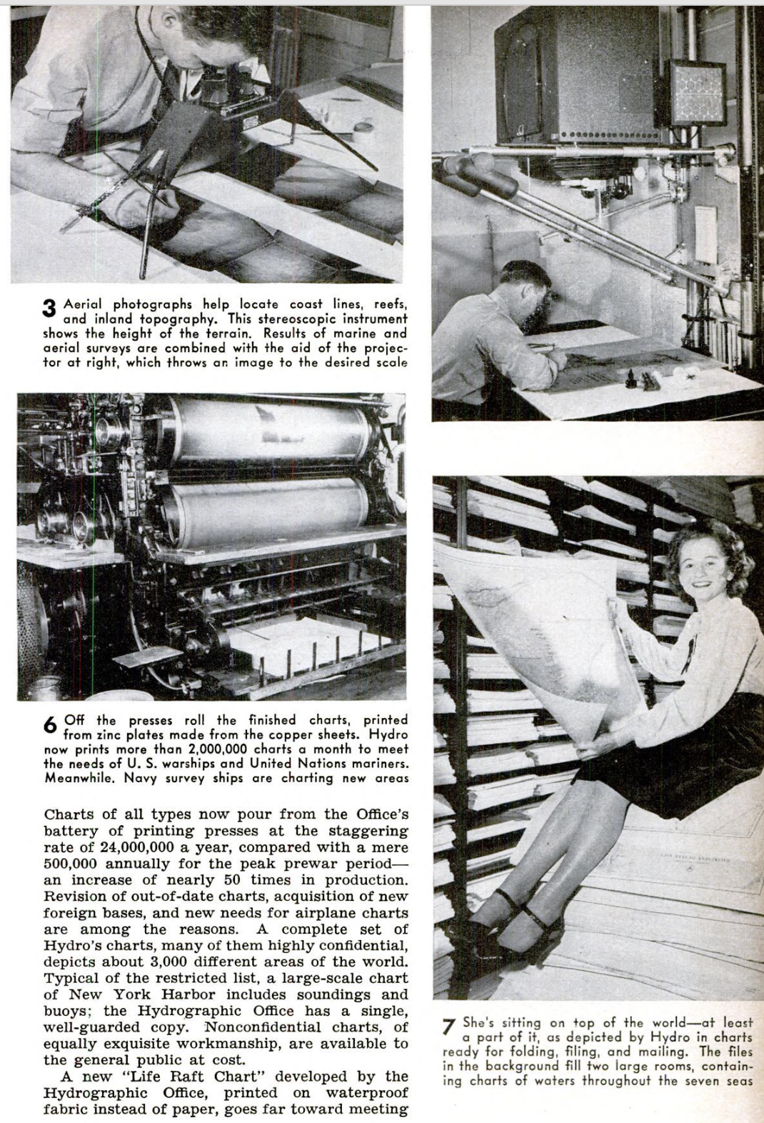
Advised of the derelict’s position by tele-
type from official New York headquarters,
Hydro relayed details to Washington and
Boston radio stations. Shortly the warning
went crackling through the ether to vessels
at sea on a scheduled “BAMS” program—
“Broadcast to Allied Merchant Ships.” Next
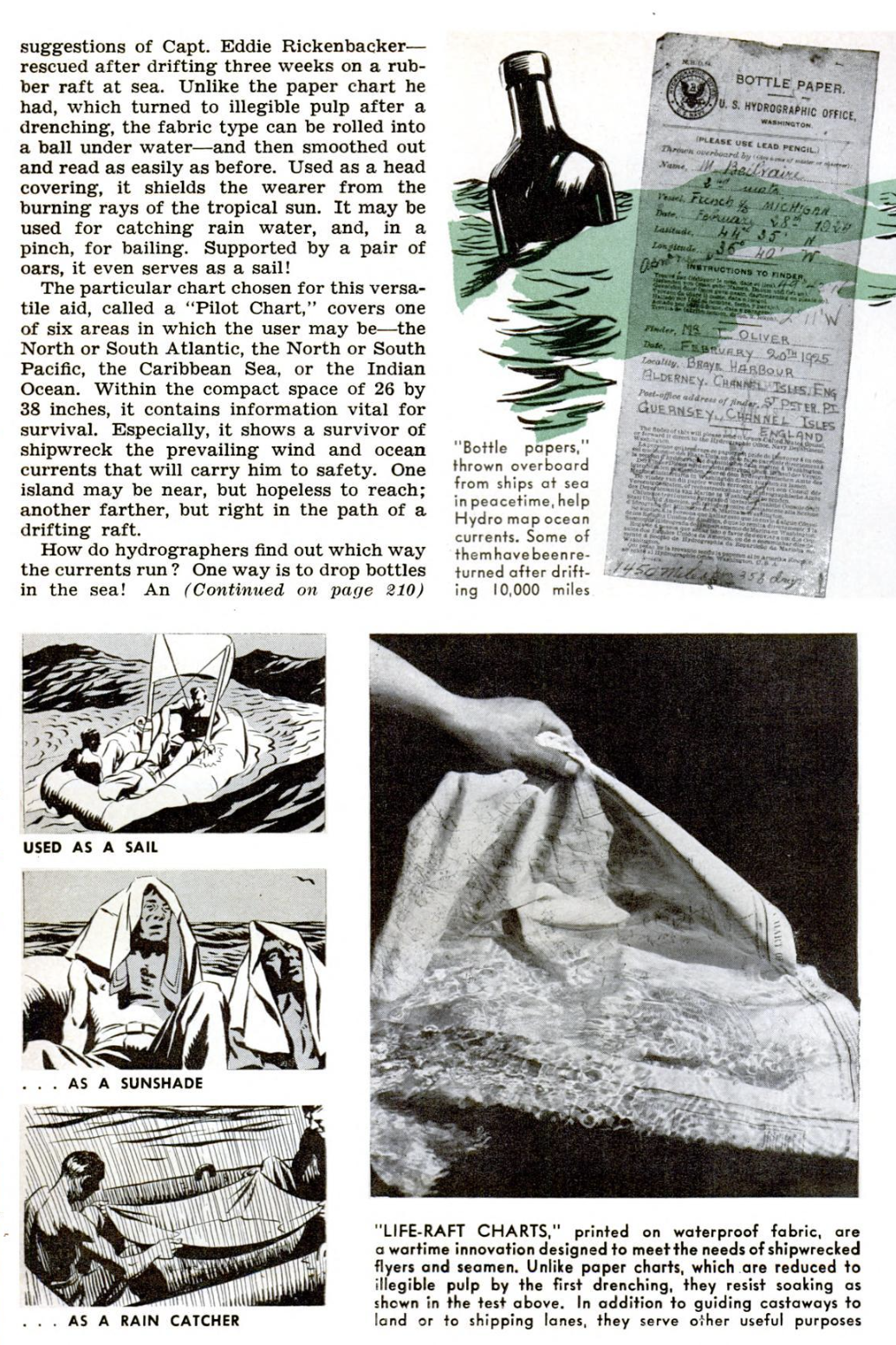
day, substantially the same message ap-
peared in the Hydrographic Office's “Daily
Memorandum.” It read:
“NEW YORK HARBOR, SUNKEN
WRECK, BUOY ESTABLISHED.—Wreck
Lighted Buoy 29A, colored black and show-
ing a quick-flashing light of 20 candlepower,
was established on April 25, 1943, in 45 feet
of water, 1,225 yards 56° from Robbins Reef
Light. The buoy is located about 225 feet
east of a wreck which lies approximately
northwest and southeast with superstructure
showing above water.” For good measure,
the warning also appeared in Hydro's week-
ly “Notice to Mariners,” another of its in-
valuable publications for seafaring men.
Finally, in case there is no immediate
prospect of removal of such a hazard to
navigation, official charts of the area are
stamped with the necessary correction—
which may be a pictorial symbol for a
derelict, a lozenge and a sunburst for a
lighted buoy, and the letters “Qk F1 G” for
quick-flashing green. Newly established
lights and other aids to navigation are in-
serted in similar fashion.
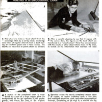
Perhaps this may be getting ahead of
the story. Preparing the original charts
themselves constitutes one of the most re-
sponsible duties of Rear Admiral G. S. Bryan,
Hydrographer of the Navy, and of the
Hydrographic Office which he heads. For
victory in battle and safety in little-known
waters, warships and cargo vessels alike
depend upon the accuracy of these “road
maps of the sea.”
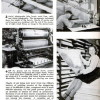
Some idea of war demands upon Hydro
may be taken from newly available figures.
Charts of all types now pour from the Office's
battery of printing presses at the staggering
rate of 24,000,000 a year, compared with a mere
500,000 annually for the peak prewar period—
an increase of nearly 50 times in production.
Revision of out-of-date charts, acquisition of new
foreign bases, and new needs for airplane charts
are among the reasons. A complete set of
Hydro’s charts, many of them highly confidential,
depicts about 3,000 different areas of the world.
Typical of the restricted list, a large-scale chart
of New York Harbor includes soundings and
buoys; the Hydrographic Office has a single,
well-guarded copy. Nonconfidential charts, of
equally exquisite workmanship, are available to
the general public at cost.
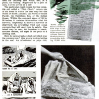
A new “Life Raft Chart” developed by the
Hydrographic Office, printed on waterproof
fabric instead of paper, goes far toward meeting
suggestions of Capt. Eddie Rickenbacker—
rescued after drifting three weeks on a rub-
ber raft at sea. Unlike the paper chart he
had, which turned to illegible pulp after a
drenching, the fabric type can be rolled into
a ball under water—and then smoothed out
and read as easily as before. Used as a head
covering, it shields the wearer from the
burning rays of the tropical sun. It may be
used for catching rain water, and, in a
pinch, for bailing. Supported by a pair of
oars, it even serves as a sail!
The particular chart chosen for this versa-
tile aid, called a “Pilot Chart,” covers one
of six areas in which the user may be—the
North or South Atlantic, the North or South
Pacific, the Caribbean Sea, or the Indian
Ocean. Within the compact space of 26 by
38 inches, it contains information vital for
survival. Especially, it shows a survivor of
shipwreck the prevailing wind and ocean
currents that will carry him to safety. One
island may be near, but hopeless to reach;
another farther, but right in the path of a
drifting raft.
How do hydrographers find out which way
the currents run? One way is to drop bottles
in the sea! An
imaginative youngster, recovering a corked
and message-holding bottle from the surf,
may anticipate finding a romantic message
of shipwreck. But the slip of paper he reads
is headed “BOTTLE PAPER. U. S. Hydro-
graphic Office.” Then follows the name of
the officer who tossed the bottle overboard,
his ship, the date, the latitude, and the
longitude. In eight languages there follows
a request to the finder to add his own name
and address, plus the date and place where
he picked up the bottle, and to return the
slip to the Hydrographic Office or to the
nearest American consul in his country.
Because ships do not care to reveal their
positions in wartime, distribution of “bottle
papers” has ceased for the duration. But
returns are still coming in. Some of the
bottles travel far and long. One bobbed
about in the Pacific until it was more than
10,000 miles from its starting point—and
this is not a record.
In one office, you meet an expert in the
Japanese language. Surrounded by flower-
ornamented dictionaries, he is diligently
“translating” Japanese charts that may be
of service to American warships.
Moonlight charts, showing the brightness
of the moon at various times and locations,
are another reminder of war. They indicate
when darkness will cover a raid on enemy-
held territories.
By the time that the United States en-
tered the war, American pilots were well
acquainted with “Approach and Landing
Charts,” newly developed by Hydro, which
enabled flyers of average skill to make safe
landings in totally unfamiliar and obscure
places.
An improved star finder and identifier,
developed by the Hydrographic Office, eases
the task of aerial navigators, especially when
clouds obscure a part of the night sky. This
outfit includes a star map and a series of
interchangeable scales, each corresponding
to a certain latitude. When the proper scale
is mounted on the map and set according to
the observer's local meridian, the altitude
and azimuth of any visible stars may be
read from the scale markings.
As an indication of the variety of Hydro's
publications, one of the most recent bears
the title, “Eskimo Place Names and Aids to
Conversation.” Standard “Pilots,” supple-
menting nautical charts, give detailed direc-
tions for reaching desired destinations, much
after the fashion of automobile guide books
—except that lighthouses and buoys replace
road forks and railway bridges.
-
Contributor (Dublin Core)
-
Alden P. Armagnac (writer)
-
Language (Dublin Core)
-
eng
-
Date Issued (Dublin Core)
-
1943-10
-
pages (Bibliographic Ontology)
-
97-100, 210
-
Rights (Dublin Core)
-
Public Domain (Google digitized)
-
Archived by (Dublin Core)
-
Matteo Ridolfi
-
Alberto Bordignon (Supervisor)


 Popular Science Monthly, v. 143, n. 4, 1943